April 13, 16
Hello everyone!
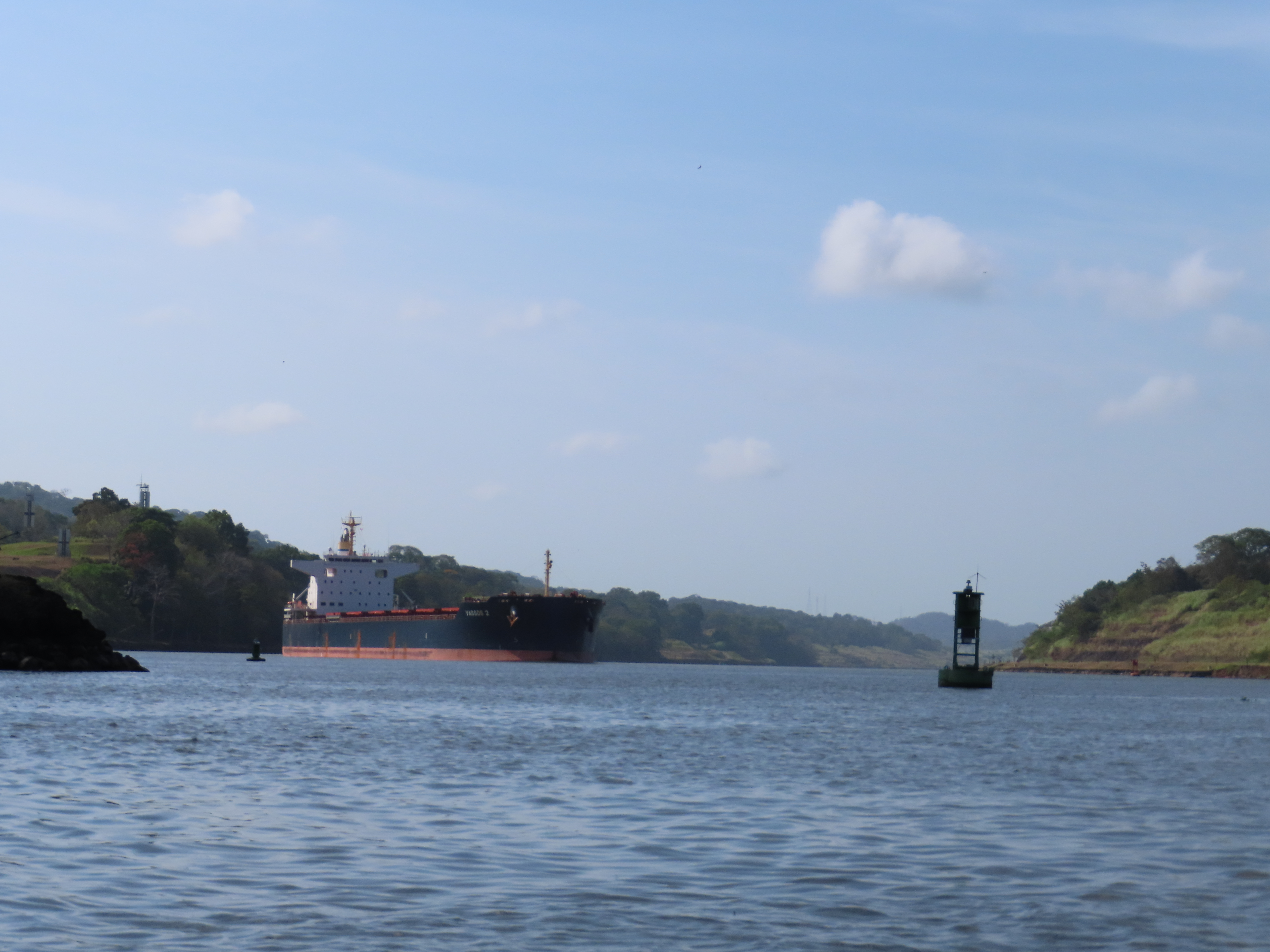
When you picture ‘Panama’, there’s a strong chance that you’re picturing a large ship slowly steering itself through a narrow stream of water. That water is known as the Panama Canal. It has defined this isthmus for…well, arguably since its discovery by Europeans.
 |
| Millions of years ago, a canal wouldn’t have been
needed - this whole area was underwater
|
 |
| Visible from the sky as we flew into Panama City |
It’s undoubtedly an industrial wonder of the world. A feat of human engineering that transformed the twentieth century. A vital artery for the global economy. It belongs to Panama. It hasn’t always been Panama’s Canal, and certain individuals don’t think it should be theirs anymore. But enough about that for now.
 |
The Panama Canal handles 5% of global maritime
traffic, and 40% of all US container traffic |
A journey through time, excellently explained both at the Museo de Canal in Panama City and at the Miraflores Lock Visitor Centre, helps you learn about its turbulent and deadly history. Firstly it was the Spanish, in the 16th Century, who were keen to link the Atlantic and Pacific Oceans through one of the narrowest points on land in the Americas. They failed.
 |
| Miraflores Lock |
 |
Crossing Panama was dangerous, but even on horse and foot,
it was much quicker than going around South America |
They kept trying, but it was the Kingdom of Scotland who next tried, albeit at an area slightly further southeast in the Darien region. They failed. The Scottish almost bankrupted themselves with this venture to the point that it is credited as one of the reasons for them joining the United Kingdom through the Act of Union in 1707.
 |
After the British attacked Portobelo in Panama in 1739, the
Spanish directed trade traffic around Cape Horn instead |
In the following century, it was the United States of America that pushed for a connection, either through Panama or Nicaragua to the north. Bizarrely, it was faster, cheaper and more secure for people on the East Coast of the US to travel to the west, specifically California for its Gold Rush, than traversing over land. What transpired was not a canal at this point but a railway. It’s still in use today, linking Panama City on the Pacific with Colon on the Caribbean.
 |
| It's no longer the original railroad |
Then along came the French. Ferdinand de Plessis, fresh from helping to create the Suez Canal, was approached to create something similar across Panama. He travelled to Bogota, as Panama was part of Gran Colombia at this point, and gained a concession to build a canal. France poured money and men into the project from 1881. They failed.
 |
Tensions between Panama and the United States were
already high at this point. This newspaper article
tells the tale of the 'Watermelon Slice' incident. |
Enter the United States once more, this time with more force. With American backing, Panama declared independence from Colombia and gained independence over a 48 hour period in November 1903. Within that same month, a treaty was signed giving the US the right to build a canal.
 |
| The US Seal for the Panama Canal Zone |
 |
| Theodore Roosevelt was the US President at the time |
Controversially, what was also given to the US was a ‘zone’, 5 miles (8 kilometres) either side of the proposed canal, which essentially became American land in Panama. Panamanians were banned from this area. Moments after their independence, they were once again at the whim of a larger, essentially colonial power. I’ll come back to this later.
 |
| The Canal Zone was American territory |
 |
Cerro Ancon was out of bounds for Panamanians. When returned
in 1977, they almost immediately hoisted an enormous Panama
flag. As you'll see later, flags are important to this story. |
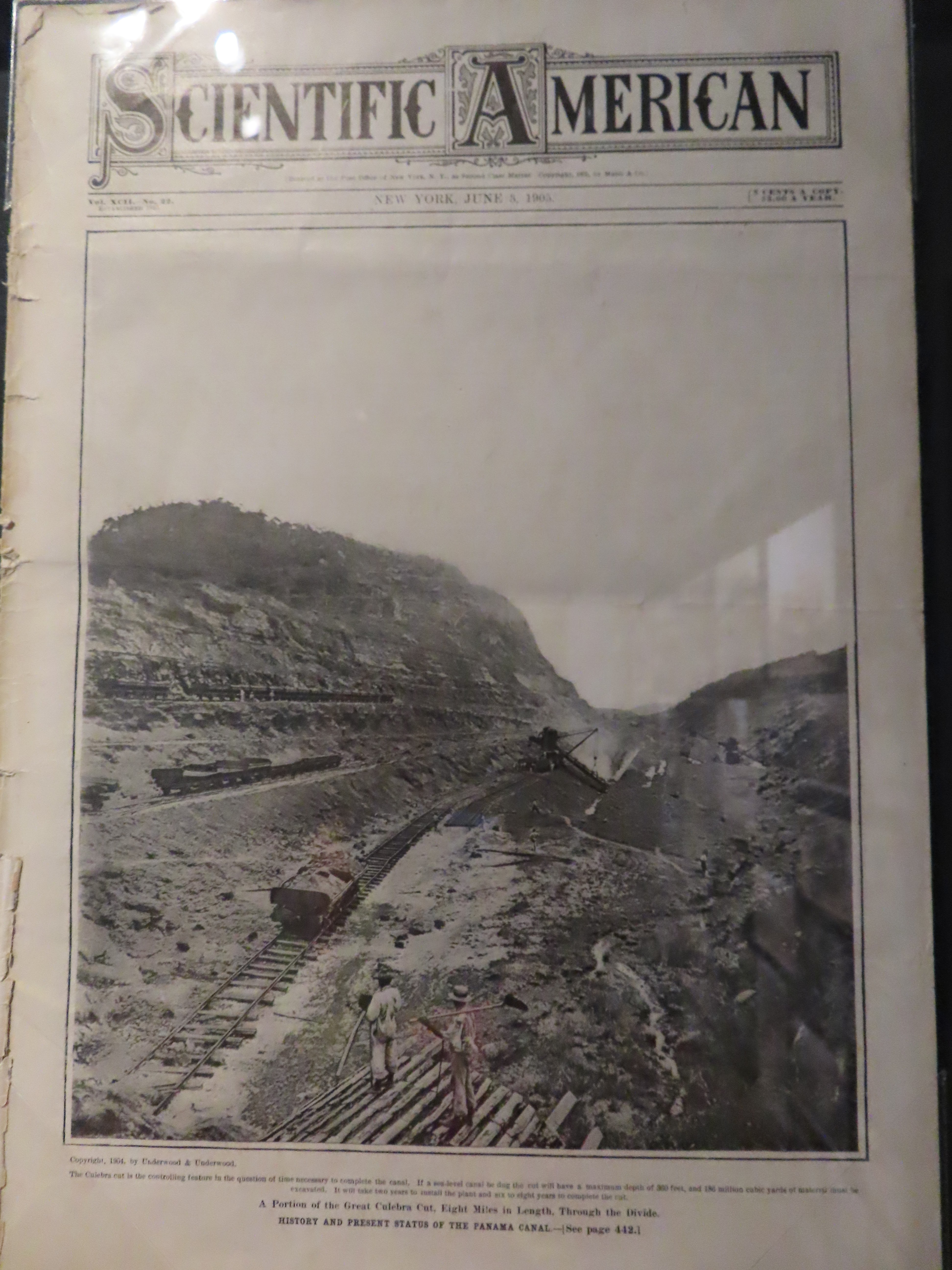
As I’m sure you’re aware, the Americans…didn’t fail. Their strategy was different to previous attempts, damming a section of the Chagres river to flood a large tract of land in the middle of the country. This meant that the ‘building’ of the canal was restricted to cutting through a short mountain range, known as the Culebra Cut.
 |
The flooding led to multiple manmade lakes beng created.
I'll tell you more about these next time. |
 |
The US bought a lot of the machinery
France had left behind to engineer the cut |
Not that this was easy, of course. The project took 10 years. It cost one year of the annual US Federal Budget. Over 5,000 people died, though this could have been a lot more - research in the early phase led to a better understanding of tropical diseases such as yellow fever, and how to prevent them. It was inaugurated on August 15, 1914. As incredible as this was, the event was actually overshadowed by other news: the First World War officially started on the same date in Europe.
 |
| Souvenir edition of a trave magazine |
 |
| The American cargo ship SS Ancon was the first to pass through |
Since then, the Panama Canal has been used to save time and money for ships, people and companies transporting items as diverse as cars and corn between the world’s two largest oceans.
 |
One concern for the future is water scarcity. At 507 Litres per
person, Panama ranks fourth globally in terms of water use. |
 |
More than 13,000 annual transits, 180 maritime routes that
reach 1,920 ports in 10 countries. Massive numbers. |
How it works is through a lock system. That flooded area mentioned earlier is 26 metres above sea level. Three locks at each end help raise ships of any size and stature. It is quick, efficient and utterly mind-blowing to watch.
 |
| This image shows the locks raising a boat from the Caribbean Sea to 'lake level' |
 |
Crossing the Panama Canal can take up to 10 hours as you need to
wait for your direction of travel to move, and for each boat to do each lock |
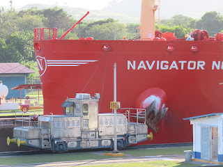 |
| Notice where the pole is in relation to the text... |
 |
Compared with about a minute later...
|
American success in constructing the canal came with plenty of bonuses. For one, it helped to spread American culture across Latin America. In Casco Antiguo, the old town, there is an establishment called ‘Cafe Coca-Cola’. It is the oldest cafe in the city, dating back to 1875, and changed its name in 1906 to cash in on Americans arriving during the construction process. They were initially given permission by Coca-Cola to use their brand, as this was before the age of copyright. When the soft drink giant changed their mind and tried to sue the cafe twice in the 1950s…they failed. Deciding it wasn’t worth their time to pursue, it means that this is the only place in the world that can use the Coca-Cola brand at its convenience without any copyright issues.
 |
Famous visitors include Che Guevara, Roberto Duran and
apparently Daniel Craig when filming Quantum of Solace |
 |
| Stock photo - it was VERY busy when we entered |
Mainly, the US got to hold a strip of land either side of the Panama Canal. This became known as the Canal Zone: American land in Panama. It would become a major cause of conflict and resentment in the country.
 |
| The Amador Causeway was off-limits for Panamanians until the 1970s |
 |
| The construction of the canal led to many migrants arriving, resulting in greater diversity
|
One reason was segregation - not just separating Panamanians, but also within the zone that was governed under US laws that enshrined racial segregation at the time. Another was a very different interpretation of the 1903 treaty between the countries. One example was a modification in 1936 that the US decided would allow them to build military bases outside of Zone territory.
 |
Gold Roll folk are at the front. They had more rights and money.
Silver Roll are behind. Fewer rights and less money. Notice a difference? |
 |
The rainforest was a training ground to help the US
prepare for the Vietnam War, as well as other
challenges. Neil Armstrong is in this picture... |
After the Second World War, Panamanian protests stepped up. Their flag, and the fact that it wasn’t allowed to be raised in the Canal Zone, became a symbol of youthful protest. They take their flag seriously here - a whole section of the Museo de Canal is dedicated to it.
 |
It's even been in space! Astronaut Scott Parazynski,
a distant relative of a participant in the construction
of the Panama Canal, took it out of Earth in 2007. |
 |
| They really love their flag |
Particularly when it gets manhandled. This happened on January 9, 1964. The resulting clashes left dozens dead and led to Panama breaking diplomatic relations with the US. Relations were restored later in the year, with the agreement that both countries would seek to pursue a fairer treaty.
 |
There were disagreements on both sides over
which flags could be flown in the Canal Zone |
 |
| This flag was torn, which led to three days of violence |
This was signed off by President Carter in 1977. The agreement would end the Canal Zone and transfer complete control of the Panama Canal to Panama in 1999. The country was under military rule at this point and had to cope with a US invasion in 1989, just 10 years before the deadline.
 |
Jimmy Carter and Omar Torrijos, presidents of
their respective countries, shaking on the agreement |
 |
The US operation was called 'Just Cause', with the aim of removing
General Manuel Noriega. He surrendered in January 1990. |
Nevertheless, Panama gained control of the canal in December 1999, subsequently expanding it to fit larger ships and bringing in between five and eight times the amount of revenue than when the United States controlled it. This possibly explains one reason for the current US administration’s desire to wrest back control of the Panama Canal.
 |
| A newspaper article from the day Panama 'received' the Canal |
 |
| A sign memorialising the dates of non-Panamanian control |
It’s interesting to know that cycling along the Amador Causeway or climbing Cerro Ancon wasn’t possible for Panamanians less than 50 years ago. It's just one stor of so many that I didn't know about the history of both Panama and its world-renowned canal. For centuries a dream of invaders, the Panama Canal is now a reality that has helped this country achieve much more prosperity than it could have imagined.
 |
This image, from the end of the IMAX movie at the Miraflores
Visitor Centre, states that the expansion of the Canal
opened in 2016. It cost $5.6 billion to make. |
 |
| Cruise ships also pass through the Canal |
 |
| Owned by Panama |
Love you all,
Matt